Allegheny – Pennsylvania
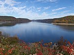
Pennsylvania’s only National Forest includes Kinzua Dam and Allegheny Reservoir on the Allegheny Plateau in the northwestern part of the state. The forest contains the largest tract of remaining old-growth forest in Pennsylvania at Tionesta Scenic and Research Natural Areas and 10 mi (16 km) of the North Country Trail. – 513,655 acres (2,078.7 km2). – 41°39′N 79°01′W
Los Angeles – California
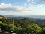
Located in the San Gabriel Mountains at the edge of the Los Angeles metro area, this National Forest includes five wilderness areas. Much of the forest is dense chaparral. Elevations in the forest range from 1,200 feet (370 m) to 10,064 feet (3,068 m) at the summit of Mount San Antonio. – 661,565 acres (2,677.3 km2) – 34°24′N 118°10′W
Angelina – Texas
Primarily longleaf, loblolly, and shortleaf pine, the forest includes two wilderness areas and borders the Sam Rayburn Reservoir. The forest provides habitat for the endangered red-cockaded woodpecker and wintering habitat for bald eagles.154,140 acres (623.8 km2) – 31°13′N 94°17′W
Apache-SitgreavesArizona, New Mexico
Encompassing the Mogollon Rim and White Mountains, this forest includes 34 lakes and over 680 miles (1,090 km) of rivers and streams, more than any other National Forest in the arid Southwest. – 2,626,306 acres (10,628.3 km2) – 33°44′N 109°05′W
Apalachicola Florida
As the largest National Forest in Florida, Apalachicola includes over 2,700 acres (1,100 ha) of water and 67 mi (108 km) of the Florida Trail. There are caverns and sinkholes at the Leon Sinks Geological Area, while Fort Gadsden is along the Apalachicola River. 30°11′N 84°41′W
Arapaho – Colorado
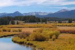
Arapaho National Forest is in the high Rockies and includes six wilderness areas. It is currently managed jointly with Roosevelt National Forest and Pawnee National Grassland. The highest paved road in North America ascends Mount Evans at an elevation of 14,265 ft (4,348 m).720,418 acres (2,915.4 km2) –39°41′N 105°56′W
Arapaho National Forest is in the high Rockies and includes six wilderness areas. It is currently managed jointly with Roosevelt National Forest and Pawnee National Grassland. The highest paved road in North America ascends Mount Evans at an elevation of 14,265 ft (4,348 m).720,418 acres (2,915.4 km2). 39°41′N 105°56′W
Ashley National Forest manages the Flaming Gorge National Recreation Area and the High Uintas Wilderness. Kings Peak at 13,528 ft (4,123 m) is the highest point in Utah and is located in the Uinta Mountains.1,378,424 acres (5,578.3 km2). 40°38′N 110°06′W
Beaverhead-Deerlodge
Montana 45°30′N 113°00′W 45°30′N 113°00′W
|
3,362,638 acres (13,608.1 km2) | The largest National Forest in Montana, it encompasses several mountain ranges of the Rocky Mountains. The forest includes the Anaconda-Pintler and Lee Metcalf wilderness areas and sections of the Continental Divide Trail and Nez Perce National Historic Trail. |
|---|---|---|
Bienville
Mississippi 32°16′N 89°30′W 32°16′N 89°30′W
|
180,251 acres (729.4 km2) | Located in central Mississippi, this forest includes several lakes and reservoirs and Harrell Prairie, the largest and least disturbed prairie in the state. Bienville Pines Scenic Area includes 189 acres (76 ha) of old-growth forest. It is managed collectively with Mississippi’s five other National Forests. |
Bighorn
Wyoming 44°32′N 107°21′W 44°32′N 107°21′W
|
1,105,311 acres (4,473.0 km2) | In the Big Horn Mountains of north-central Wyoming, Bighorn National Forest has eight lodges, several reservoirs, and 1,500 mi (2,400 km) of trails. Elevation reach 13,167 ft (4,013 m) at Cloud Peak in the Cloud Peak Wilderness, which is also the location of the Cloud Peak Glacier. |
Bitterroo t Montana, Idaho Montana, Idaho 45°46′N 114°17′W 45°46′N 114°17′W
|
1,594,579 acres (6,453.0 km2) | Bitterroot National Forest is located in the Bitterroot and Sapphire mountains, reaching its highest point at 10,157 ft (3,096 m) at Trapper Peak. The forest is named for the bitterroot plant. |
Black Hills
South Dakota, Wyoming 44°00′N 103°47′W 44°00′N 103°47′W
|
1,250,866 acres (5,062.1 km2) | Consisting predominately of Ponderosa pine, this forest is located in the namesake Black Hills. There are 11 reservoirs, 353 mi (568 km) of trails, and 1,300 mi (2,100 km) of streams in this forest. Black Elk Peak is the highest point in South Dakota and the highest point in the United States east of the Rocky Mountains at 7,244 ft (2,208 m). |
Boise
Idaho 44°07′N 115°34′W 44°07′N 115°34′W
|
2,648,273 acres (10,717.2 km2) | Portions of the Boise, Payette, and South and Middle Forks of the Salmon River drainages make up the forest. There are over 7,600 mi (12,200 km) of streams and more than 250 lakes and reservoirs in the forest. |
Bridger-Teton Wyoming Wyoming 42°45′N 110°45′W 42°45′N 110°45′W
|
3,383,302 acres (13,691.7 km2) | As part of the Greater Yellowstone Ecosystem, Bridger-Teton National Forest has 27 glaciers in its portion of the Wind River Range. The Gros Ventre landslide formed a dam on the Gros Ventre River in 1925 before failing in 1927. |
